I’ve written two historical romance books set in the 1880s in Hartford, an imaginary village in North Devon. “The Mazzard Tree” and “The Angel Maker” are part of the “Hartford Manor Series” and I’m working on the third book to complete the trilogy. Part of the story is set in the town of Barnstaple and although I know the town well, I’ve been carrying out some research to find out a bit more about its history.
In 930 the town received a charter from King Athelstan, allowing it to hold markets and a fair and it had its own mint before the Norman Conquest in 1066. Barnstaple is said to be the oldest borough in England.
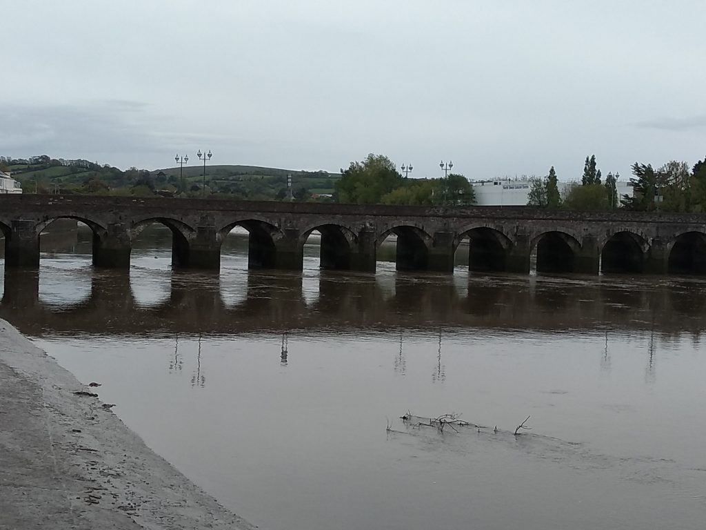
The ancient Longbridge in Barnstaple is known to have already been in existence in 1200. It was originally constructed as a packhorse bridge with large refuges to allow walkers to escape the horses. It is thought the end of the bridge nearest to the town may once have had a drawbridge. All sixteen arches are built of stone and over the centuries it has been widened and strengthened.
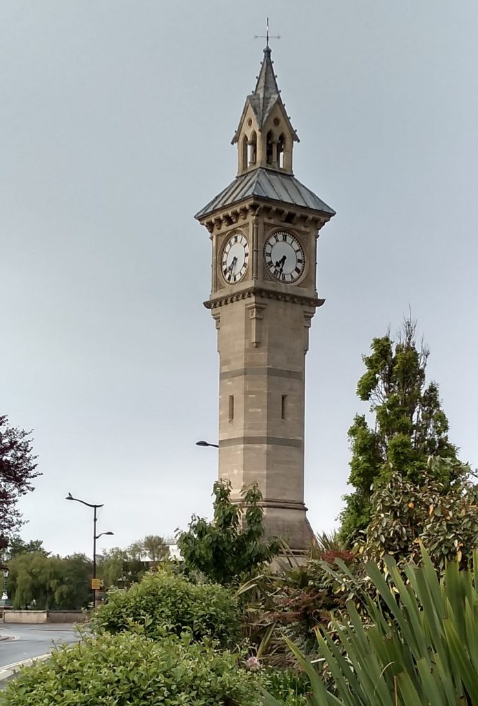
On the 14th of December 1861, Prince Albert, consort to Queen Victoria, died of typhoid fever at Windsor Castle. Victoria was overwhelmed with grief and remained in mourning for the rest of her life. All around the country communities decided to commemorate the Prince and many buildings and statues were erected in his memory.
Barnstaple decided to erect a tower, but various councillors suggested as the town had no public clock, it would be an ideal opportunity to include one in the design. The clock is known locally as the four faced liar, because only one of the clock faces on each of the four sides of the tower ever tells the correct time.
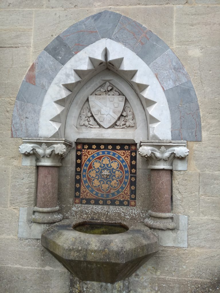
This ornate mosaic is on one side of the Albert Clock, with a Victorian drinking fountain.
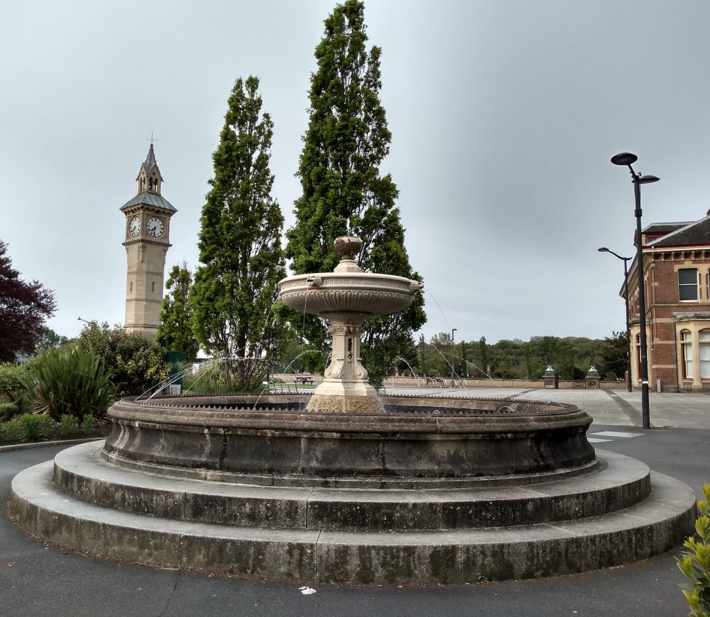
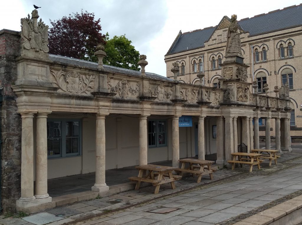
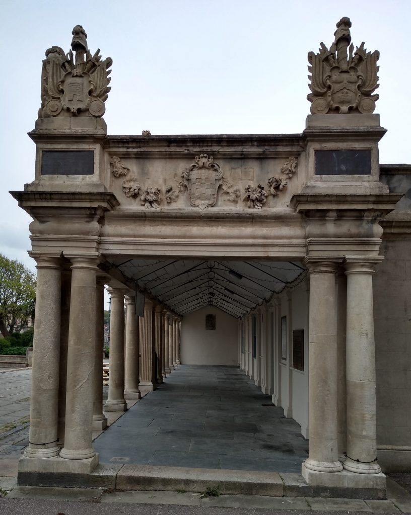
In front of the Albert Clock is another well known feature of the town. The listed water fountain was erected to record the gift by CS Willshire Esq of the railings enclosing the square during his mayorality in 1876-1878. The memorial was designed by local surveyor RD Gould and was built by a local builder by the name of John Pulseford for £216.
The Square was once a desolate beach washed over twice a day by the tides. It was so marshy that even when the tide was out, it could only be crossed on a path of raised stones. An open sewer once ran across the middle, carrying gutter water from the High Street. The High Street itself would have looked very different in the past, with overhanging thatched roofs dripping onto the cobbled street below. Small-paned shop windows would have been lit only by candles and the town had many little courts of cottages. Pigs rootled in the open drain which ran down the middle of the street.
Between The Square and Queen Anne’s Walk lay the Great Quay where ships unloaded their cargoes. In 1837 over 100 types of commodities were brought in by sea. Between the Walk and the quayside stood a flagpost, next to which was a small canopy sheltering the official scales. These were used to weigh woollen goods and the famous Barnstaple Baize. One of the taverns along the quay was called The Star Inn and with its cellars and shop, must have been the first port of call for many a sailor.
Five ships sailed from the Great Quay to join Francis Drake at Plymouth to fight the Spanish Armada. The ships were called “The Dudley”, “The God Save Her”, The Tiger”, “The John of Barnstaple” and “The Unicorn”.
This is a photograph taken from the end of Queen Anne’s Walk. The building is used as a popular tea room today and picnic tables can be seen in the previous photograph, allowing visitors to eat outside during the Coronavirus pandemic.
In the past the Tome Stone was situated in Queen Anne’s Walk and was replaced with a newer version in 1633. Merchants paid on the Tome Stone and this is where the saying “paid on the nail” comes from. The deposit of money on the stone, in front of a witness, clinched a deal.
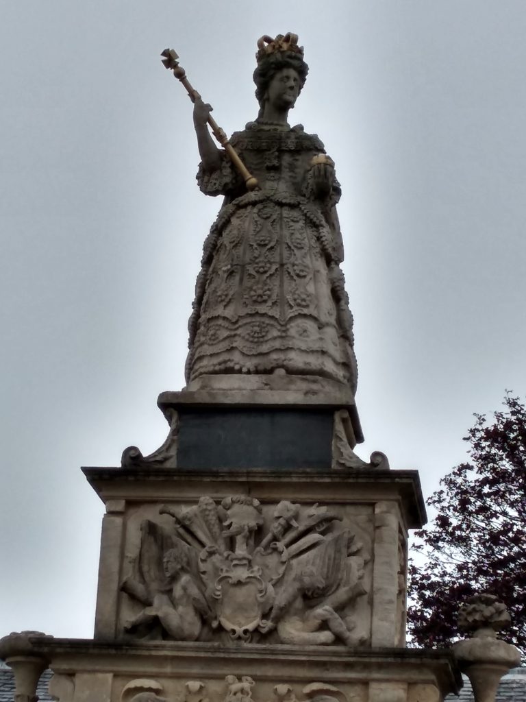
Queen Anne’s Walk began life as a simple pier built out from The Great Quay and was previously known as Merchant’s Walk. However, in 1708 the statue of Queen Anne was gifted to the town by Robert Rolle of Stevenstone.
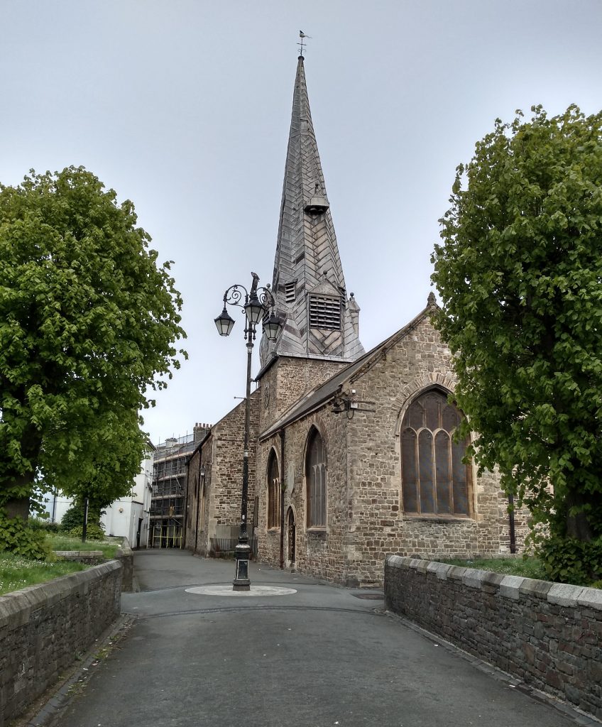
The Parish Church of St Peter was built in 1318 on the site of an earlier place of worship. Its twisted spire is a well-known landmark in the town. Anyone taking a shortcut through the churchyard from Boutport Street to High Street will have noticed that the ground level of the churchyard is around chest height and there is a robust stone wall lining the pathways. However, I wonder how many passers-by realise that these walls are said to hold in many thousands of dead bodies that were buried there over the 550 years that the graveyard was in use.
In 1849 a report revealed that a portion of the wall of the yard was raised 18 inches in order to prevent human bones from falling out of the soil and onto the path as they had done in the past.
Another report told of a funeral a few years before where the corpse was placed within six inches of the surface. Several wells near the graveyard, used by local brewers for their water, were contaminated by fluids from so many bodies. Following these horrific stories, the government ordered the closure of the churchyard. However, owing to various local and political arguments this was not achieved until some seven years later in 1856, when the borough cemetery in Bear Street was opened. Obviously red tape is nothing new.
This is St Anne’s Chapel in Paternoster Row, situated adjacent to St Peter’s Church. The upper part of this building dates from 1450, but the base and the crypt are much older and date to 1330. At first it was used as a charnel house, where human skeletal remains were stored. Charnel houses are often built near churches for depositing bones that are unearthed while digging graves.
Later it became a Chapel of St Anne and was used by the Huguenot refugees for their religious services. The Huguenots came to Barnstaple from France in 1685. They were seeking refuge from persecution following the revocation of the Edict of Nantes by Louis XIV. Many settled in Barnstaple, inter-marrying with Barumites and with their names translated, or anglicised, their descendents still live there today. The building later became used as a Grammar School.
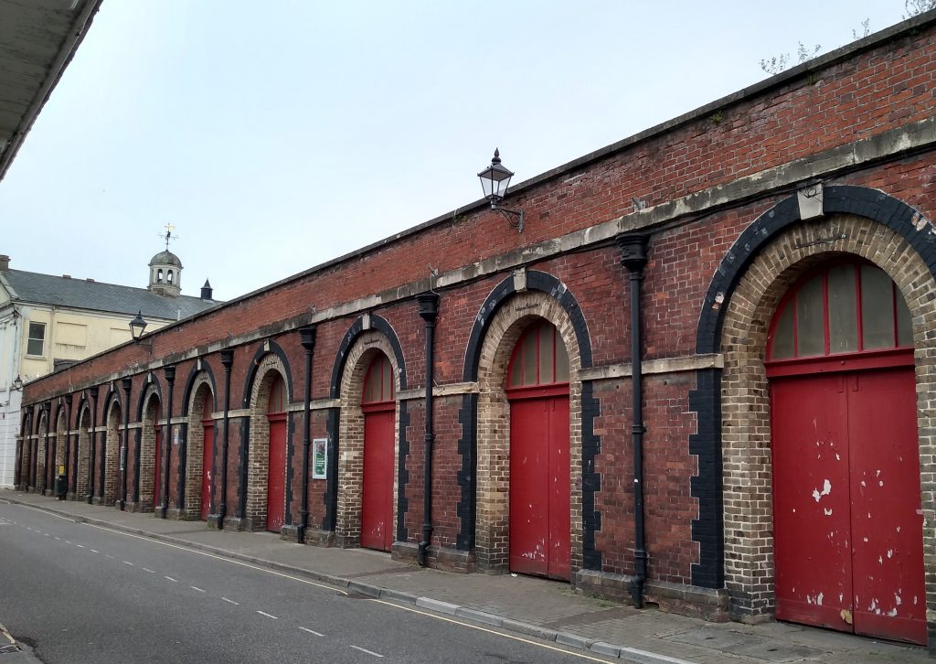
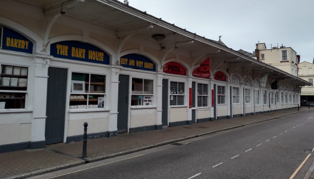
Just a short distance from St Peter’s Church is Barnstaple’s famous Pannier Market. Built in 1855, the Pannier Market was designed by local architect, R D Gould. This photograph shows the outside of half of the building, taken in Butcher’s Row, towards the Guildhall and the High Street. On market days the red doors are wide open and inside are many stalls offering a wide selection of goods.
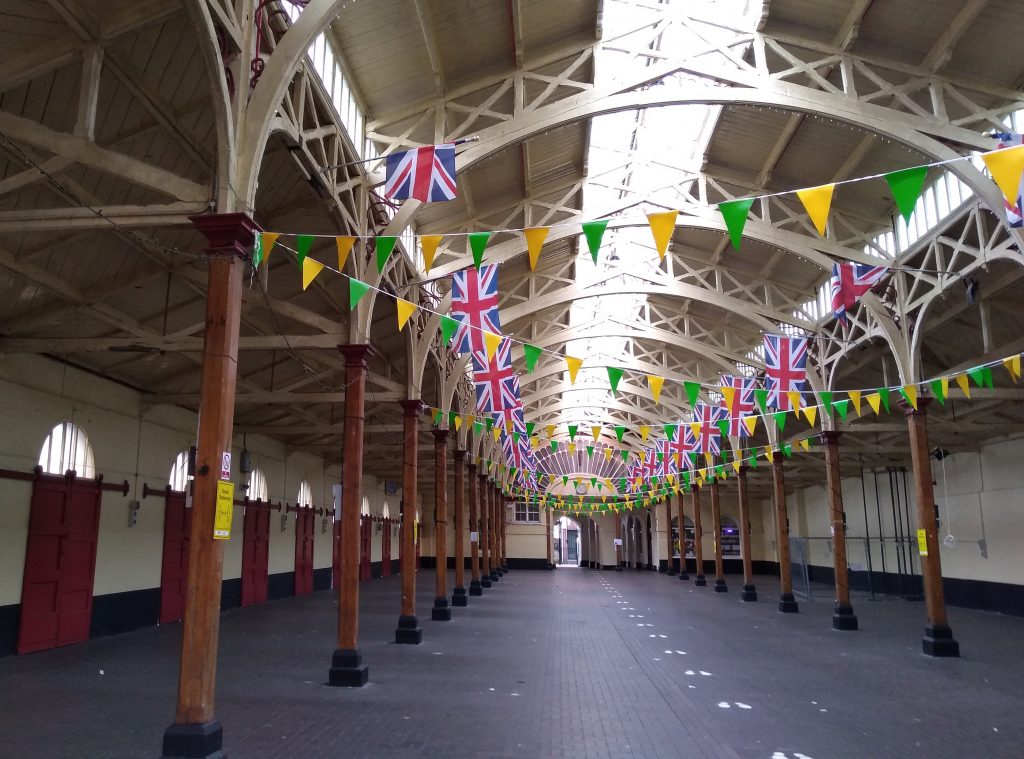
This is a photograph of the inside of the Pannier Market. Markets are normally held on Tuesdays, Fridays and Saturdays, with other events such as craft fairs being held on other days. In the past, a wide range of plants, vegetables, fruit, cream, eggs and poultry were on sale, but these days less fresh produce is on offer.
Butchers’ Row is situated on the other side of the street from the Pannier Market and was also built in 1855. Originally there were 33 small shops and there was an elaborate archway at each end. However, these were removed to allow delivery lorries access. The architectural flair associated with the Victorian period is evidenced here with the Bath stone and elegant wrought iron roof supports.
For many years, this was The Three Tuns Inn, situated in the High Street in Barnstaple and just opposite the end of the Pannier Market. It was originally built as a merchant’s house and was bought in 1415 for £8. By 1704 it was a public house.
It was bought by Mr Easton in 1837 and he remained there for many years. It opened at 6 am so that Barumites could buy their penny tot of rum and their ha’penny screw of tobacco on their way to work.
In the 1870’s the famous Fair Ale or mead, drank at the opening of Barnstaple Fair each year, was brewed there. The secret recipe is handed down from one senior Beadle to the next and was made using water drawn from the ancient lead pump in the yard.
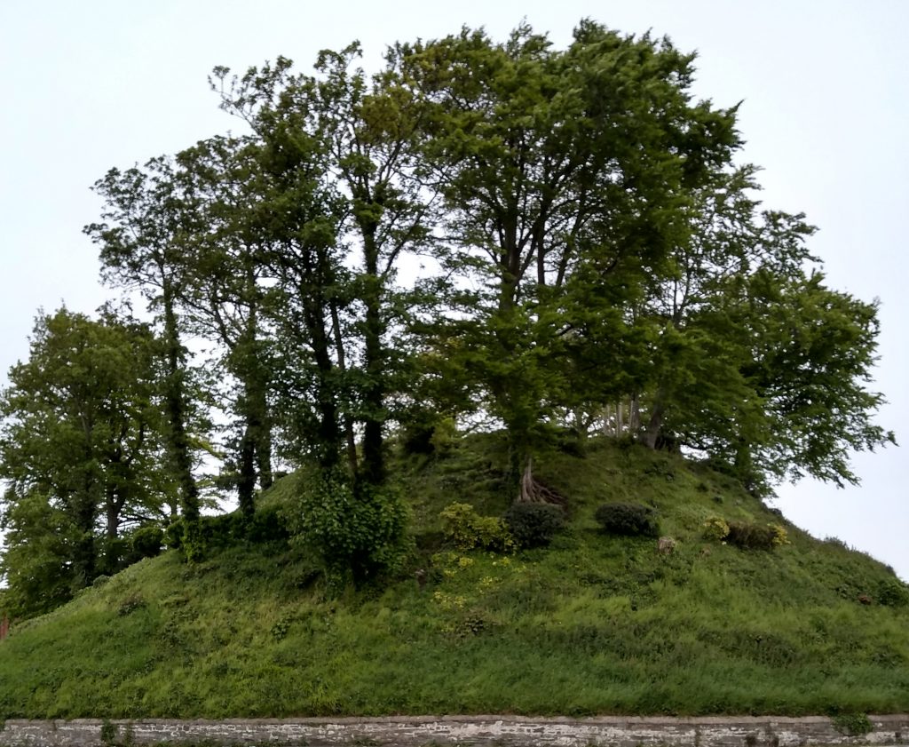
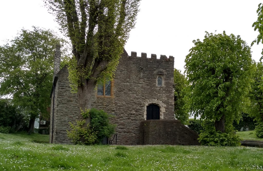
This is the Barnstaple motte which is all that remains of a medieval motte and bailey castle. It was probably under construction by the time of the Domesday Book of 1086, although it is not recorded in documents until the 12th century. A document of 1274 indicates the presence of a hall, chamber, and kitchen on the motte. The motte is a well-known and dominant feature in the western part of the town, standing on the east bank of the River Taw at its confluence with the River Yeo.
Excavations conducted within the castle grounds in 1972-75 revealed the presence of 105 graves forming part of a Saxon cemetery which was in use at the time of the Norman Conquest. It is possible to walk to the top of the mound and enjoy the view of the surrounding area.
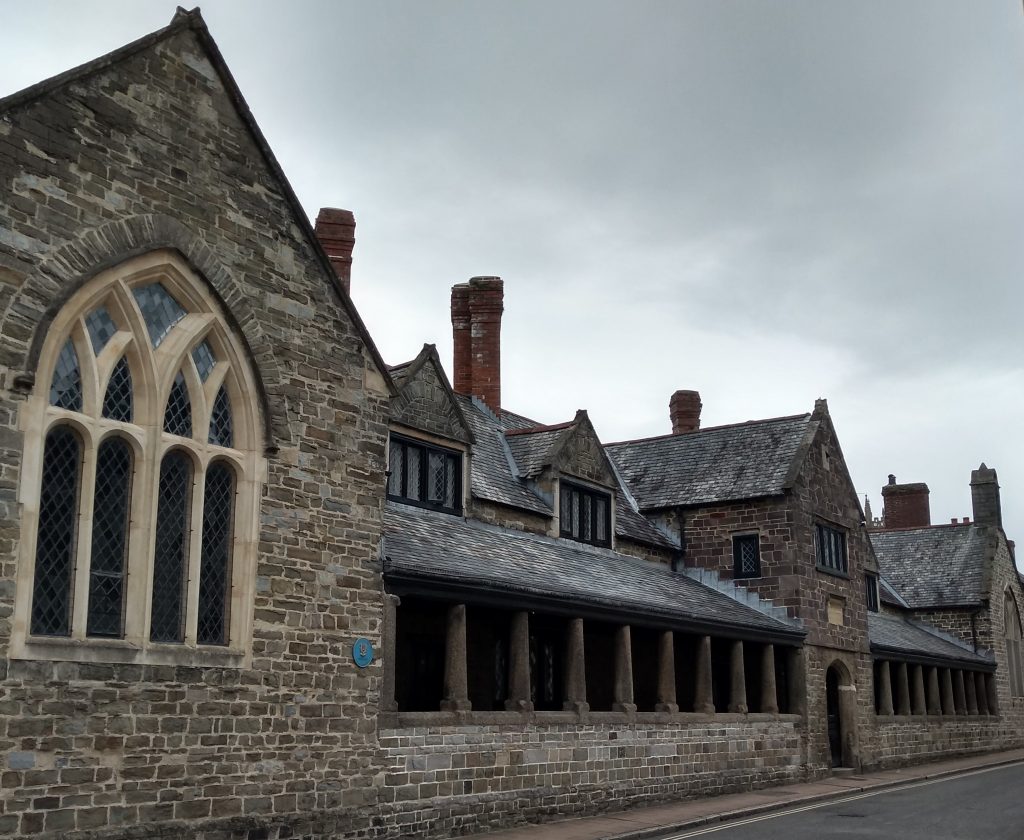
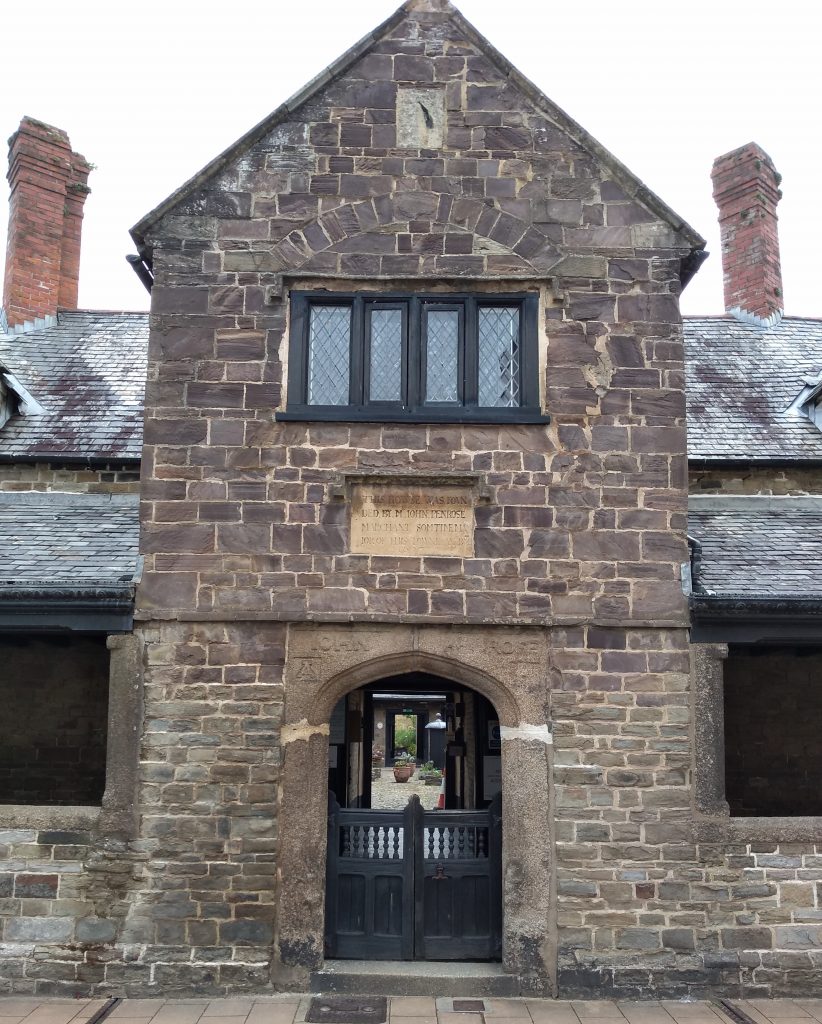
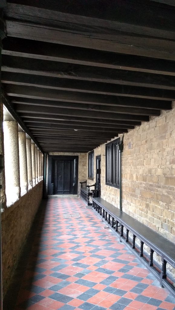
The Penrose Almshouses are situated in Litchdon Street and close to The Square. They were built between 1624 and 1627 by John Penrose, a cloth merchant and mayor of the town. The twenty almshouses are all accessed through a common entrance colonnade of granite pillars and each dwelling had its own garden plot. The ancient front door still bears the bullet holes which bear witness to a skirmish in Litchdon Street in the Civil War.
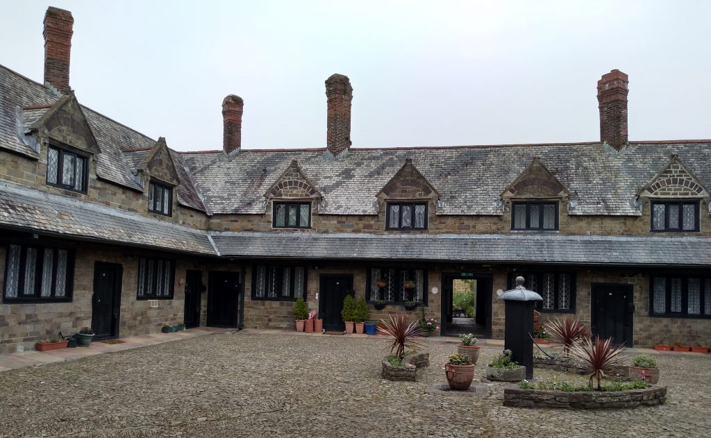
The entrance leads into an attractive cobbled courtyard where the ancient communal pump can still be seen.
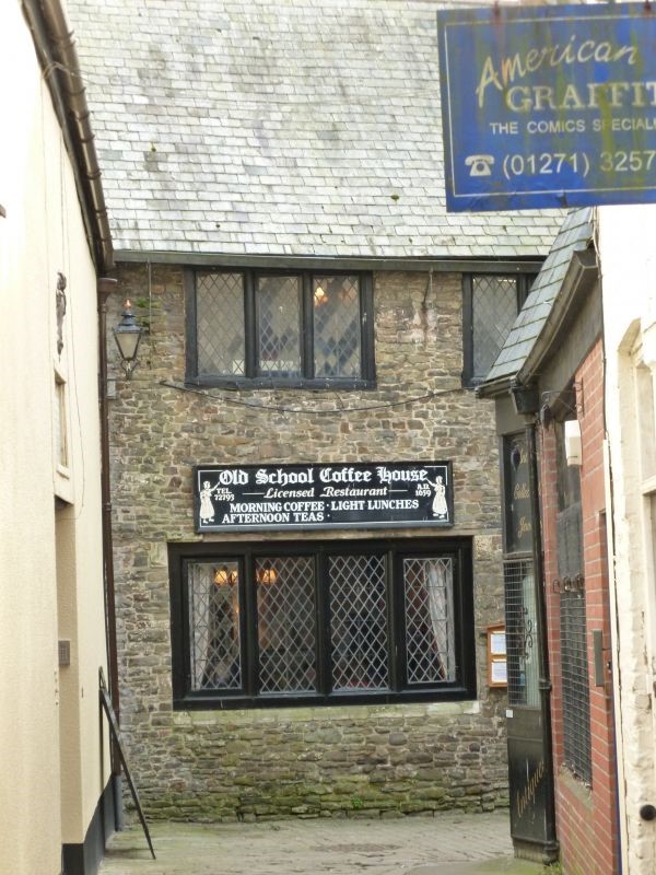
Another interesting building in Barnstaple is the Alice Horwood School, now used as a café and called “The Old School.” The school room was on the ground floor and the living accommodation above.
The Horwoods were a notable family in Barnstaple. Thomas Horwood, a mayor of the town, provided almshouses for “poor and ancient people” in 1646, a time of a severe plague in Barnstaple. (I wonder if that is how the Coronavirus will be described in years to come)? When Thomas died in 1658 he left the four almshouses to his wife Alice, who continued their use and built eight more. She also started a school for poor children next door. A plaque outside states “1659. This school for 20 poore maids was founded and built by Alice Horwood.”
The girls learned reading, sewing and knitting, but not writing as this was thought unnecessary for girls. The girls also made shirts and stockings for the Blue Coat School boys using the local woollen cloth known as Barnstaple Bayes.
This is the monument at the entrance to Rock Park, which is situated along Taw Vale and adjacent to the river Taw. The park was presented to his native town by William Frederick Rock (1802 – 1890). Rock was born in Barnstaple and educated at Christ’s Hospital, London. His first job was in a bank in Bideford. He later moved to a bank in London and set up his own printing press. He was well known for writing poetry and was a very wealthy man. Mr Rock had to go to quite a lot of expense to provide the park. He purchased an old factory, ruined cottages, timber and brickyards and a limekiln. All were demolished and the area drained and tidied. The limekiln left a huge, but unstable mound, which was cleared away and a rustic bandstand built in its place.
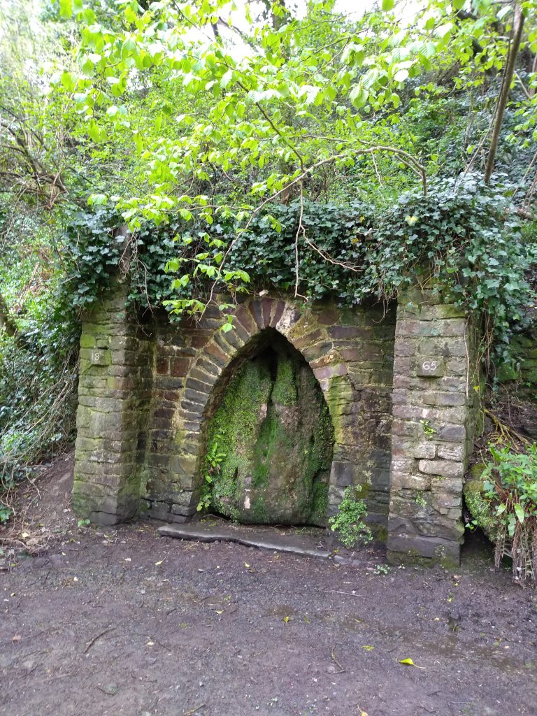
This is the Dripping Well which is situated on the outskirts of Barnstaple in Anchor Woods. The Victorian stone arch was built in 1865 and surrounds a mineral spring with waters rich in calcium. Water from the well was once collected for medicinal use, helping to cure stomach acidity, gallstones and complaints of the eye.
I hope you have enjoyed this short history of Barnstaple. Readers of the third book in my Hartford Manor Series will recognise some of the places mentioned in my story.
0 Comments